
Walk a Madison Heights Street
Start a Madison Heights street directory search with one complete address. The city assessment file and Oakland County map records are keyed to parcels, not to a public list of every person on a block. First locate the parcel, preserve its PIN and legal description, and keep the situs address separate from any tax mailing address. The situs is the physical parcel location. A tax mailing address is only where notices go, and it may be outside Madison Heights. From there, land records can establish recorded parties and the historical directory layer can supply dated address clues.
- Search the address in Madison Heights assessment files or Oakland County Property Gateway. Save the parcel number, situs, owner field, mailing field, and legal description shown.
- Open the parcel in Property Gateway. Repeat a street-prefix search to inspect the separate parcel hits along the same street, rather than assuming an aerial image shows the legal boundaries.
- Use the owner name, PIN, or legal description in the Oakland County deed index. Record grantor, grantee, recording date, instrument, and book, page, or document reference when available.
- Use the Michigan Voter Information Center only for a voter checking their own status. A public QVF request has separate rules and redactions, so it is not a free street roster.
- For an older household clue, ask the Heritage Rooms, library staff, or Oakland History Center about the relevant directory or telephone-book run. Treat every directory result as a dated snapshot.
That order keeps the modern parcel trail distinct from a household trail. It also prevents a mailing address, recorded owner, deed party, or historical listing from being mistaken for present occupancy.
Madison Heights Street Directory Fields
The city advertises property-file searches by last name, property address, or parcel ID. The record can show lot or parcel size, square footage, age, rooms, bedrooms, bathrooms, garage, foundation, decks, porches, recent sales history, values, and principal-residence status. Principal-residence status is an assessment indicator, not proof of a person’s day-to-day presence. The city’s current annual files cover more than 11,600 real-estate descriptions and 1,900 personal-property accounts, but the research did not establish a published historical online cutoff.
| Assessment field | Type | Required | Madison Heights use |
|---|---|---|---|
| Last name | Text | Optional | Owner search; partial-match behavior is not published. |
| Property address | Text | Optional | Situs address; use the street number and street name. |
| Parcel ID | Text | Optional | City sales reports use a hyphenated parcel format; exact validation is not published. |
| Owner and mailing address | Result fields | Not applicable | Tax-roll contact fields that may differ from the situs. |
| Values and exemptions | Result fields | Not applicable | Assessed, taxable, SEV or appraisal, and homestead information. |
| Characteristics and sales | Result fields | Not applicable | Building details plus date, price, instrument, and liber or page where available. |
The Assessing office is also a counter and phone route for parcel questions. Its published city contact is 248-837-2644. Use that route when a screen does not answer the narrow record question; do not guess at missing historical fields.
Map a Madison Heights Street
Oakland County Property Gateway accepts a PIN or property address and requires at least five characters. It accepts partial addresses such as “1200 S,” wildcard forms such as “1% Main” and “1% S% M,” partial or wildcard PINs, and comma-separated PINs. A repeated street prefix can therefore produce a street-by-street parcel pass. Click a returned PIN or address to place the parcel on the map and open its record.
The Property Gateway landing screen shows the county’s map-based search route.
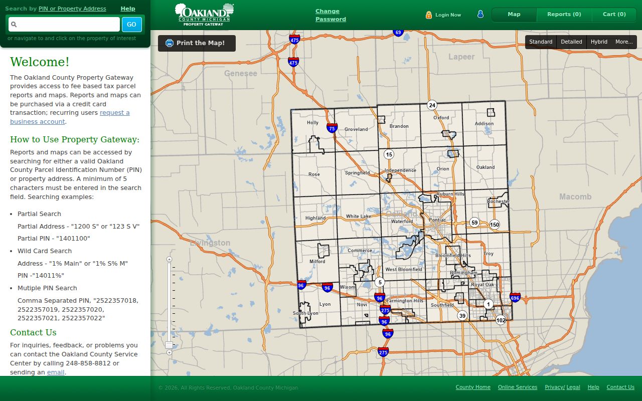
Use the map to verify parcel shapes and PINs before comparing nearby records. The county names parcel, elevation, floodplain, permit, and related mapping services, but the accessible research did not verify every live layer or a named adjacent-parcel, buffer, or measure control.
Reports and printable maps may carry a charge, while many map features are free. A business account is available for high-volume users. The free search does not turn a map result into evidence of a household.
Note: Preserve the PIN and legal description before moving from a map result to deed research.
Madison Heights Address Records
A street directory becomes more useful when each result is labeled by its record type. Parcel files identify land and tax information. The deed index identifies transactions. Permit and planning materials can document work or a public case tied to an address. They have different coverage, different access routes, and different limits. The table separates those roles so an address search remains factual.
| Address record | Keeper | What it can show | Access route |
|---|---|---|---|
| Assessment file | Madison Heights Assessing | Owner, parcel, situs, mailing, values, characteristics, sales, homestead indicator | Advertised online name, address, or PIN search; city counter or phone |
| Property Gateway | Oakland County GIS | PIN, parcel map, property hits, and available layers | Free search; some reports and maps are paid |
| Deed and land index | Oakland County Clerk/Register of Deeds | Parties, instrument, date, PIN, legal description, and deed chain | Free index search; paid image or print; counter or mail for older material |
| Permit or code file | Madison Heights Building Services | Work, applicant, owner or contractor, inspection, and address chronology | Forms, some AccessMyGov routes, office, and a narrow records request for archives |
| Agenda material | Madison Heights Planning Services | Public planning, zoning, variance, site-plan, or rezoning trail | Agenda Center phrase, date-range, and category search |
| Voter record | Michigan Department of State and local clerks | Limited registration data under statutory redactions | Own-status MVIC route or a defined FOIA request |
The Super Index covers a far larger land-record population than the city parcel system. Oakland County describes nearly 18 million land records reaching to the early 1800s, with 13.7 million records dating from 1964 searchable online. Exact online cutoffs for each document series were not published, so older material may need assistance from the Clerk/Register counter or mail route.
Madison Heights Street Directory PIN Tip
Insider tip. For a repeated street search, the best way to keep one parcel from being confused with the next is to save the ten-digit Oakland PIN whenever it is available. Oakland County identifies the PIN as the most precise property and Property Records Notification key. Street names can be abbreviated, directional prefixes can vary, and a parcel can have an older geographic label. The PIN gives the assessment file, map result, and land-index search a shared reference.
Use the PIN to check the current parcel in Property Gateway, then use it in the Super Index before relying on a name. If the record involves a suspicious claimed filing, enroll in the county’s free property-records alert service and confirm any alert directly with the Clerk/Register. A PIN narrows the land record; it does not identify every person connected with the address.
Trace Madison Heights Street Deeds
After the parcel step, search the Oakland County Clerk/Register of Deeds Super Index by the ten-digit PIN when possible, or by a party name. The county identifies the PIN as its most precise property and fraud-alert key. Search and sorting are free, but prints and downloads cost money. A deed trail follows a parcel, not a roster of people, so record the legal description as carefully as the street address.
- Parcel
- A defined piece of land used by the assessing and GIS systems. Its PIN connects map and property records.
- Situs address
- The physical location of the parcel. It differs from the address used for tax notices.
- Plat
- A recorded subdivision plan that identifies lots, blocks, streets, and other land geometry.
- Criss-cross directory
- A reverse directory arranged by address, used to look for dated household or telephone clues.
- Legal description
- The lot, block, subdivision, or metes-and-bounds wording that identifies land even when an older address varies.
Read the current conveyance, note grantor and grantee, then search the seller as an earlier grantee to move back one transfer. Mortgages, releases, liens, plats, easements, and probate transfers can explain changes in the chain. A later deed in a grantor’s name may show another transaction, but it does not establish a complete residence history.
Madison Heights Permit Addresses
Building Services keeps an address-keyed trail for building, demolition, rehabilitation, electrical, plumbing, mechanical, energy, fuel-gas, and property-maintenance work. Permit applications can name an owner, applicant, contractor, and parcel. That identifies parties to an application or project, not necessarily a person who lived at the property. Applications are accepted in person, by mail, and in some cases through AccessMyGov, with payment due when submitted.
Madison Heights Building Permits and Application Forms is the city’s documented entry point for the address route.
For planning cases, the Agenda Center can search a phrase, start date, end date, and public-board category, including Planning Commission and Zoning Board of Appeals materials. Building Services is at City Hall, 300 W. 13 Mile Road, and the research lists 248-583-0831 for the office. The city has not published an exact open-permit-history start date.
Note: Permit forms include sensitive applicant data, so use public case information without reproducing private form details.
Madison Heights Voter Limits
Myth. A public voter record does not create a free block list. Michigan’s public Michigan Voter Information Center is for an individual to check their own registration, polling place, districts, and ballot information. It is not a street-search screen. A requester seeking Qualified Voter File data uses the state’s data-request process, which permits defined scopes such as county, jurisdiction, ward, precinct, or district and has delivery and fee rules.
MCL 168.509gg requires redaction of driver-license and state-ID numbers, month and day of birth, phone, email, digitized signature, last four Social Security digits, receiving-office data, and declined-registration information. The state reported in February 2026 that a federal court dismissed litigation seeking unredacted Michigan voter information. Public access therefore remains limited by the statute.
Madison Heights Street History
Address research before cityhood needs a different label. Madison Heights incorporated from the east side of Royal Oak Township in 1955, so an older record can use Royal Oak Township, Royal Oak, a Pontiac reference, a rural route, or a different postal label. The city’s history confirms the changing jurisdiction but does not document a street-wide renumbering or renaming year. Do not create a conversion date that the record sources do not support.
The Oakland History Center shelf list names Pontiac and Oakland directory volumes from 1860 through 1962, including the 1919 rural-resident directory and later Polk volumes. Their coverage can bridge an older address, but a book’s presence does not prove every Madison Heights street was canvassed. For collection details and access choices, consult the Madison Heights city directories.
Note: Search an older parcel by legal description and township identity when a current street name returns nothing.
Madison Heights Street Directory Limits
The Madison Heights street directory cannot show every current household. Property records may omit some occupants and other household members. A deed identifies legal parties, not each person who occupied the home. Utility customer lists and delivery records are not public resident directories. Driver information is protected by the federal Driver’s Privacy Protection Act and Michigan law, so it is not an address-search route. Michigan’s Address Confidentiality Program also provides a substitute address for qualifying people at risk of physical harm.
Lawful use. Madison Heights address records are for personal research, family history, civic transparency, and property curiosity. Never use a record to stalk, harass, intimidate, or harm anyone.
When an online trail stops, a focused written request under the Michigan Freedom of Information Act, MCL 15.231 et seq. can name a particular address, parcel, record type, and date range. A public body generally has five business days to respond and may use one written extension of up to ten business days. The request does not override confidentiality rules.